| Correction with Roadmaps and Aerial Images |
A) Path correction with digital roadmaps
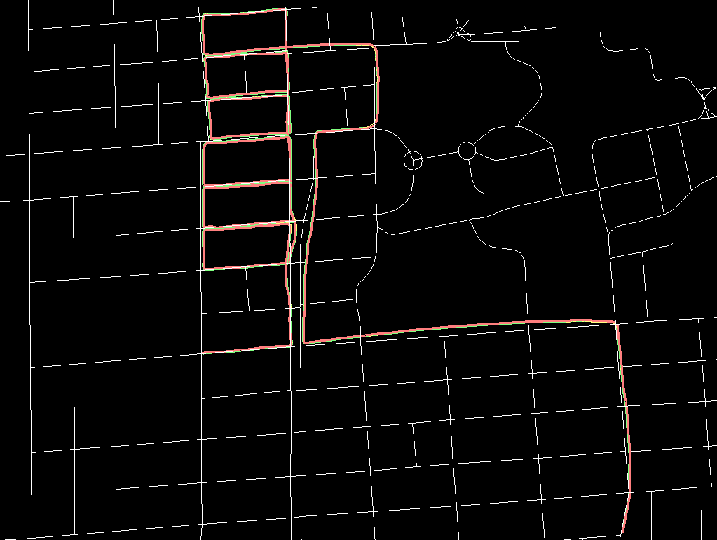
Although the initial path estimate is locally fairly accurate, traveling for several hundred meters inevitably results in an error accumulation and hence a significantly erroneous global pose. Assuming that we can only drive on public roads, the truck can be tracked in a digital roadmap (available on the web). Errors in turns can be detected using the angles of the road, and errors during straight drives using the length, respectively. The correction angles and stretch factors are then distributed among the relative position estimates according to their quality of match.
a) original path
b) corrected path
(click on pictures to enlarge)
Although this correction bounds the maximal position error that can occur, the estimation accuracy is limited by:
* width of the road
* accuracy of the digital roadmap
* the fact that we assume errors and distribute the corrections only according to the quality of match, instead of knowing in which the relative steps they actually occur
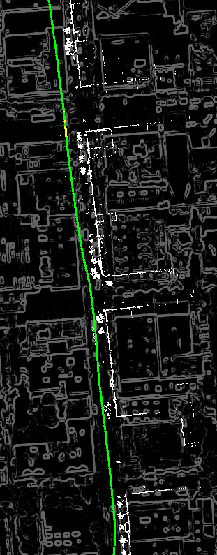
B) Position Refinement by Maximizing Cross Correlation
The coarse position estimate obtained after the digital roadmap correction can be further refined by fusing the information of both ground-level laser data and aerial images. Therefore, we take an aerial image taken from orthogonal view (and therefore with very low perspective distortion) and apply an edge detector to it. The result is a map-like edge image, and we can expect that many edges visible in this edge image have corresponding 3D edges in the ground-level laser scans. Hence, we can obtain a measure for the quality of our position estimate by matching laser scan points with the aerial edge image, and we can refine our position estimates by optimizing the quality function.
a) before refinement
b) after refinement
c) refined path overlaid with aerial image
Although we were able to track our vehicle with the methods described in B, the choice of parameters such as the correlation search range is critical. The approach described is not capable of recovering once the true position is lost and outside the search range. We have therefore developed a more robust technique based on Monte-Carlo Localization.